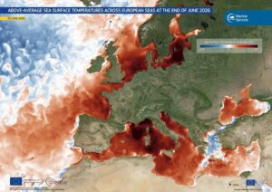
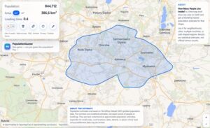
European Heat Tracker provides hourly updates on how many people are exposed to dangerous heat by overlaying live weather forecasts with high-resolution population data.
The platform combines high-resolution forecasts from Germany’s DWD ICON-EU weather model with a detailed population grid to estimate real-time exposure. Users can view the number of people in areas exceeding chosen temperature thresholds (default: 30°C), “feels-like” temperatures, or anomalies compared to the 1961–1990 climate baseline.Key features include an interactive map, country-specific breakdowns, and visualizations of unusually hot conditions. The tool highlights the growing threat of heatwaves, noting that extreme heat is becoming more frequent and deadly in Europe.
While still in beta, the European Heat Tracker offers a valuable, accessible way for the public, journalists, and researchers to monitor heat risks as Europe faces increasingly intense summer temperatures.
The open-source tool is freely available at heat-tracker.eu.