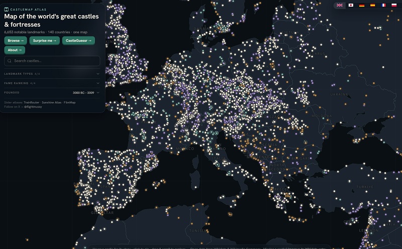

A free online atlas called Castle Map has rapidly become one of the most comprehensive digital resources for castle enthusiasts, history buffs, and armchair travelers. The site currently features 6,653 carefully curated castles, fortresses, palaces and ruins spread across 140 countries.
What the map offers
Visitors land on a striking night-themed interactive world map. Clicking any marker reveals a photo, quick facts, founding century and a link to a full page with the landmark’s story and exact coordinates. Landmarks are color-coded by type and can be filtered by category (castle, fortress, palace or ruin), fame ranking, or construction period.
Spain currently leads with 499 entries, followed by Germany (451), France (395), Italy (350) and Japan (297). Other high-ranking countries include Poland, England, Sweden, Austria and the Czech Republic.
Famous sites such as the Great Wall of China, Machu Picchu, the Palace of Versailles, the Forbidden City, the Alhambra, Neuschwanstein Castle and the Tower of London appear among the top-ranked landmarks by a “fame score” that combines Wikipedia coverage across languages and pageview data.
Built entirely on open data
Castle Map draws its information from Wikidata (facts and coordinates), Wikimedia Commons (photographs), Wikipedia (stories, including 22 language editions beyond English), and open basemaps from OpenFreeMap and Natural Earth. The project deliberately curates rather than attempts to list every fortification on Earth, focusing on sites that have a verified photo, Wikipedia article and precise coordinates so the map remains usable and balanced across countries.
The complete dataset is freely downloadable as GeoJSON or CSV under a CC0 license. Users who notice a missing castle are encouraged to improve its Wikidata entry (adding coordinates, a Commons photo and a Wikipedia article in any major language), after which it can appear in a future refresh.
Growing popularity and extra features
The site first gained wider attention in July 2026 when it listed roughly 3,700 landmarks across 131 countries and was covered by outlets including Boing Boing and GIGAZINE. It has since expanded significantly. Additional features include country and type browsing, “castles near you” day-trip guides for 240 cities, a “Surprise me” random landmark button, and a daily castle-guessing game.
No account is required and the site carries no advertising. It sits alongside other niche atlases from the same creator, such as TrainRouter, Sunshine Atlas, Detourmap and FilmMap
For anyone planning a trip, researching history, or simply wanting to lose an hour zooming across medieval strongholds and royal residences, Castle Map offers a clean, data-rich way to explore the world’s defensive and ceremonial architecture—one click at a time.