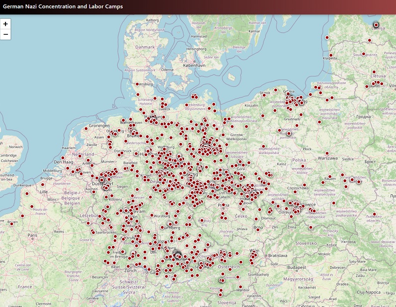

The map displays locations of main SS concentration camps and their subcamps that operated between 1933 and 1945.
The map contains the locations of over 1.1 thousand camps. Data includes opening/closing dates, peak prisoner numbers, types of forced labor, and other attributes.
The Nazi concentration and extermination camps were a network of detention, forced-labor, and killing centers established by the German Nazi regime from 1933 to 1945. Beginning with early camps such as Dachau and expanding dramatically after the outbreak of World War II, they imprisoned political opponents, Jews, Roma, Slavs, homosexuals, Jehovah’s Witnesses, and other groups targeted by Nazi ideology. The most infamous sites—Auschwitz-Birkenau, Treblinka, Sobibor, and Belzec—became centers of industrialized mass murder, where millions were killed in gas chambers or through starvation, disease, and systematic brutality as part of the Holocaust. These camps remain one of history’s clearest examples of state-sponsored genocide and human cruelty.
The map is based on The SS Concentration and Labor Camps dataset, which was developed in 2008-2012 by Anne Kelly Knowles and a number of students at Middlebury College, including Alexander Yule, Benjamin Perry Blackshear, Charlie Hoffman, and Roz Vara. The results of analysis of these data were published as chapter 1, “Mapping the SS Camps,” in Geographies of the Holocaust (Bloomington: Indiana University Press, 2014).